The Bay 2 Bay Walk

The Bay 2 Bay Walk
The blue line is the entire 200 mile Bay 2 Bay Walk. I'm doing about 175 miles of it, missing the first sections around the west coast (to begin at Arnside) and adding a bit to the east coast (to finish at Whitby).

13.8.18

Days 11 & 12 - Goathland to Robin Hood’s Bay to Whitby, 22 miles.

Total ascent, 944m (3097ft).
Sunday, 12th August.
Monday, 13th August.

It was very gloomy indeed when we got up yesterday morning, with the day’s forecast saying drizzle followed by fog followed by heavy rain followed by light rain. At 2:15pm there had been no rain at all but the Met Office App was still predicting heavy rain at 3pm for 3 hours. Then they gave up and decided it wasn’t going to rain at all. There were a few drops towards the end but that was all. I have to say though that overall the forecasts have been pretty good throughout the walk.

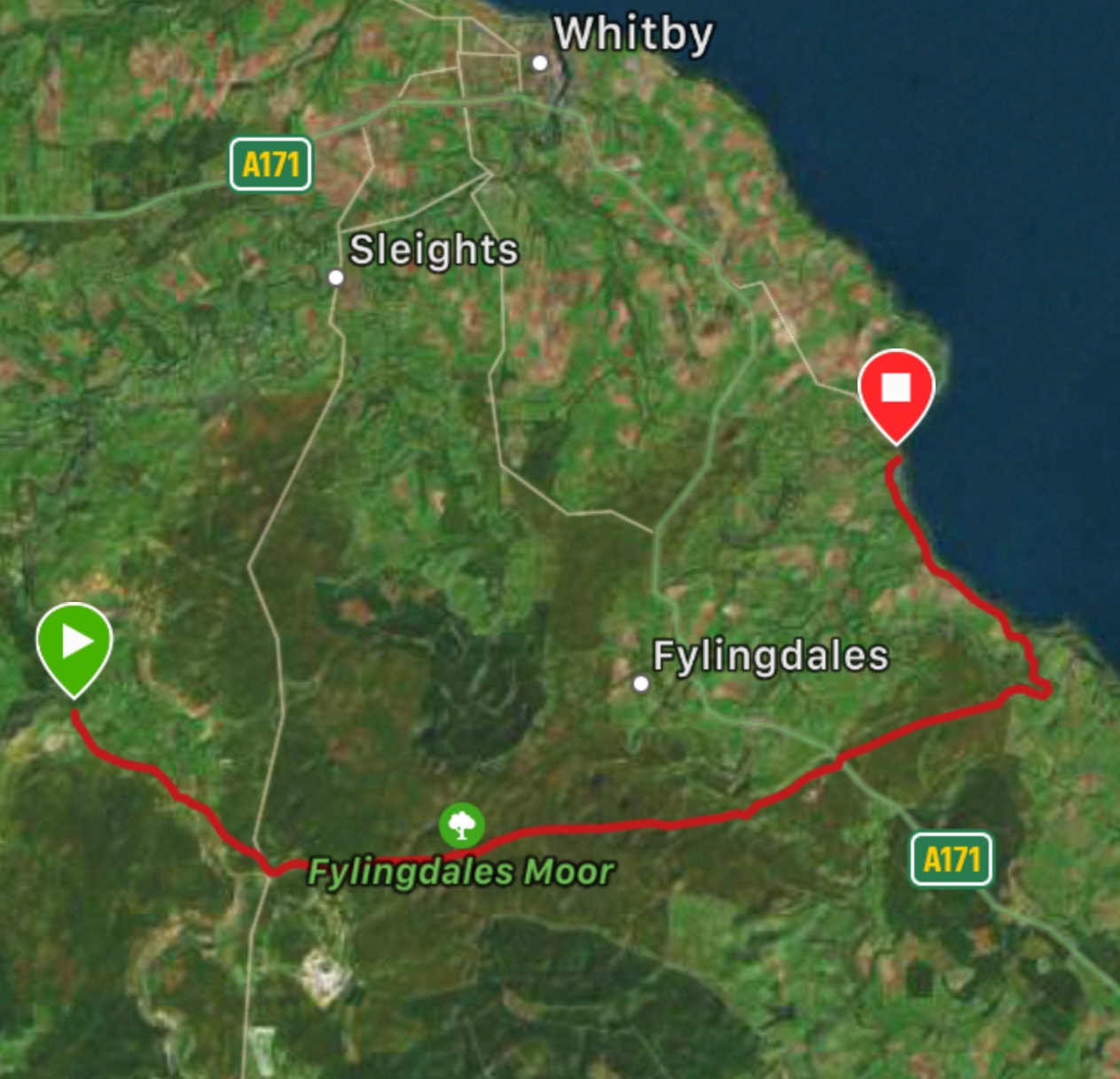
We delayed the start until the rain had moved into drizzle, but of course that had stopped too before we left the hotel. It was probably the most straightforward day of the entire walk, with good paths throughout providing great relief after the previous few days’ annoying moments. The middle section felt like we were walking pretty much in a straight line for about 4 hours. In a nutshell the beginning was on a road, the straight part was across moorland on paths and tracks and the finale was on the Cleveland Way coastal path. A few photos...


Should we be worried?!
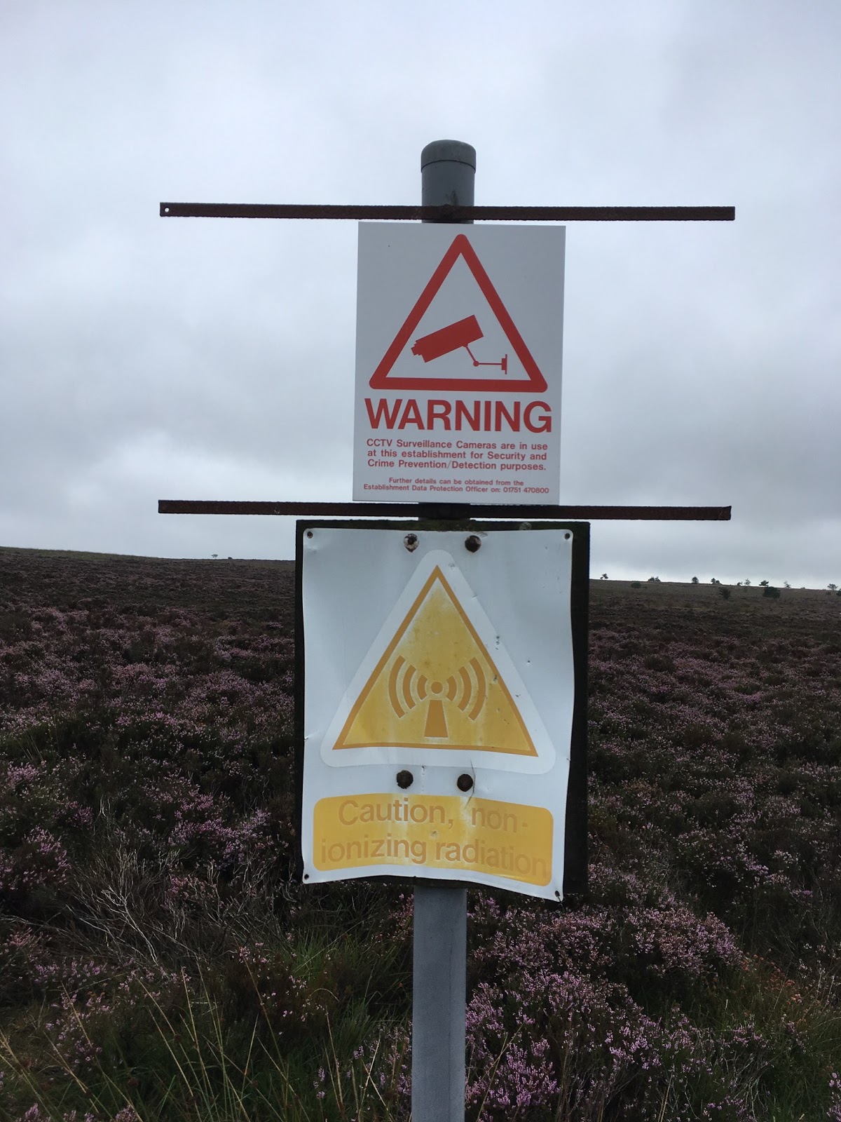

Lilla Cross.


Jen ascending.


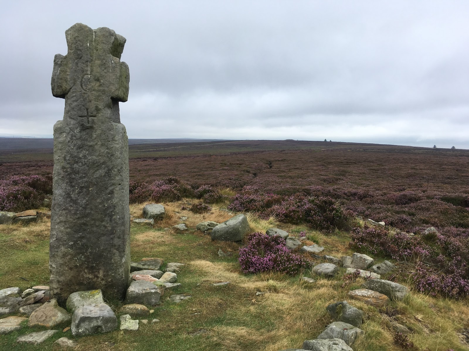
After this, no more moor.

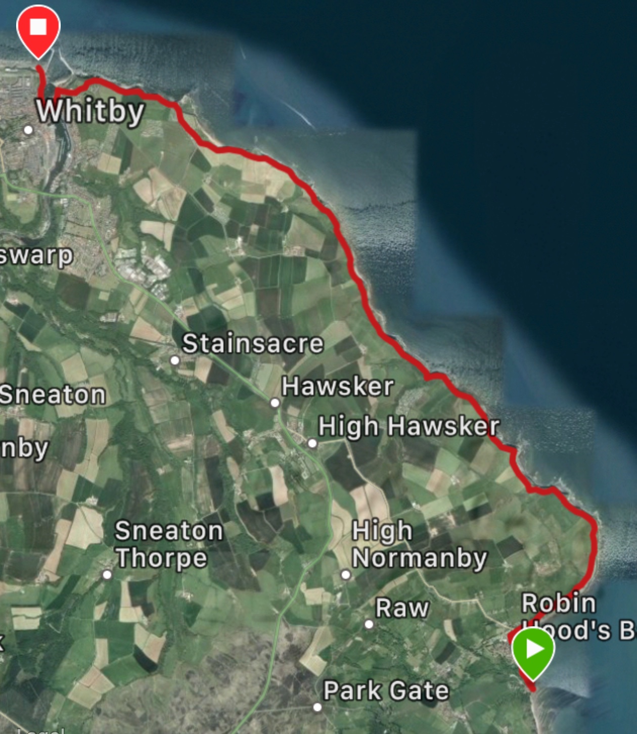
The Cleveland Way coastal section is a beauty, sticking to cliff edges almost throughout and really well constructed in the trickier bits. Like many coastal paths though it has ‘hidden’ difficulties, meaning a tendency to suddenly descend from 60 metres to sea level and head straight back up again. There were two of these killers right at the end of the walk but the payoff was worth it. 


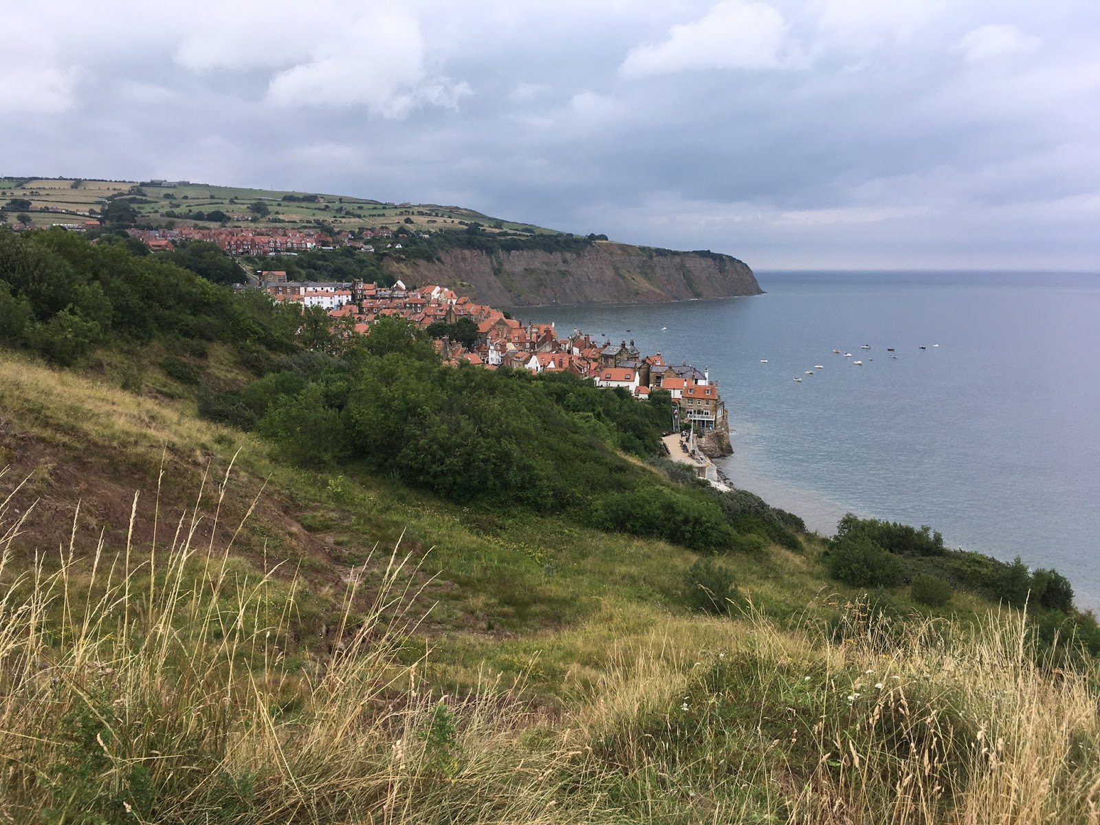
The final approach to RHB. 

Robin Hood’s Bay never fails to amaze me with the way it tumbles down to the sea, it’s stunning. I can’t even begin to imagine what’s happened in this village in the past, but we stayed in the Smugglers’ Bistro which offers a clue. And of course it’s the end of ‘The’ Coast to Coast Walk, so it’s popular with walkers. The Bay 2 Bay also finishes here but I wanted to complete this year’s odyssey somewhere else, hence Whitby.


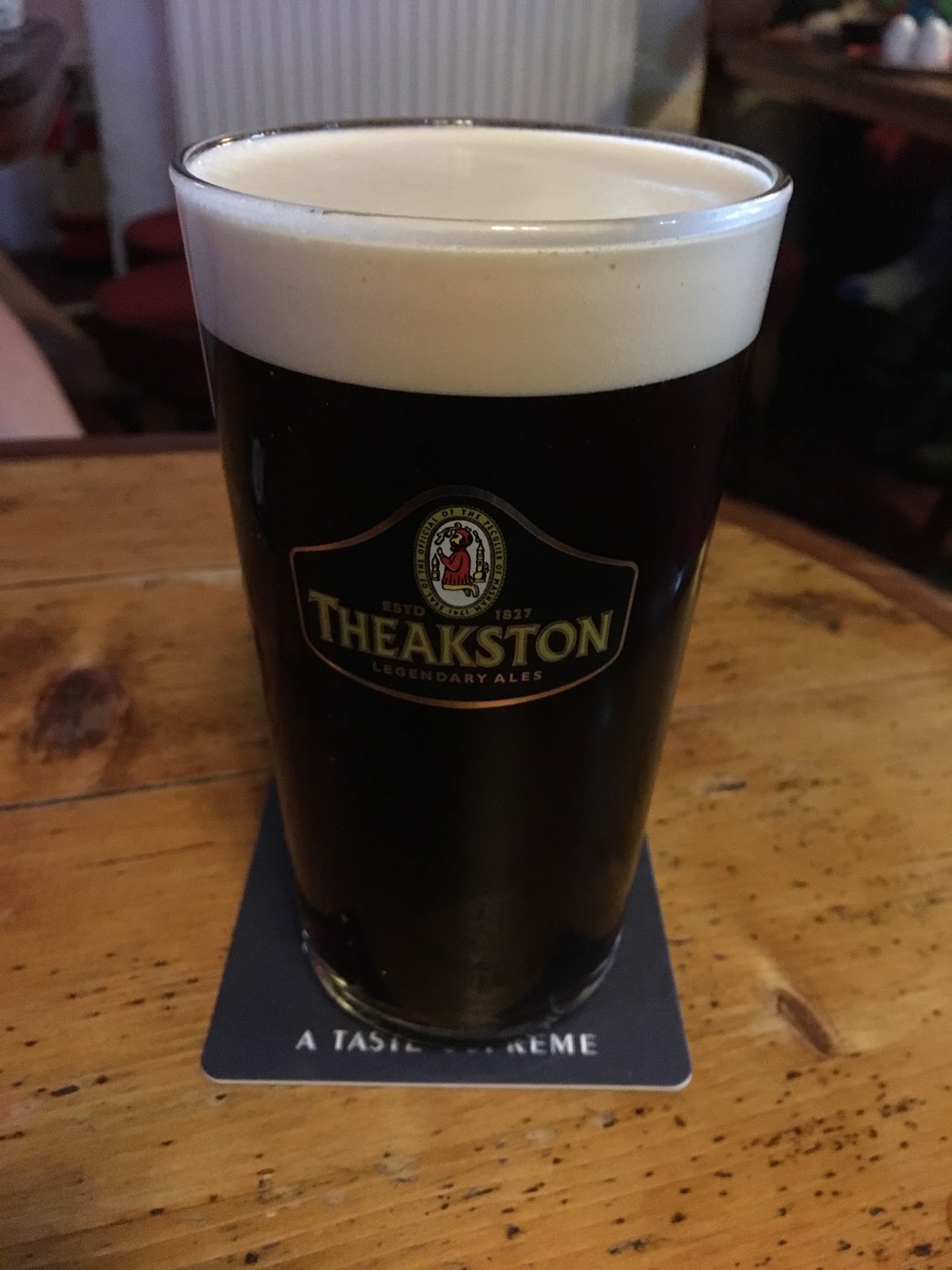
My first pint of Old Peculier during the entire walk. 

And so to today’s finale, another fine stretch of the Cleveland Way Coastal Path with superb, distant views along the north east coast. Oh...


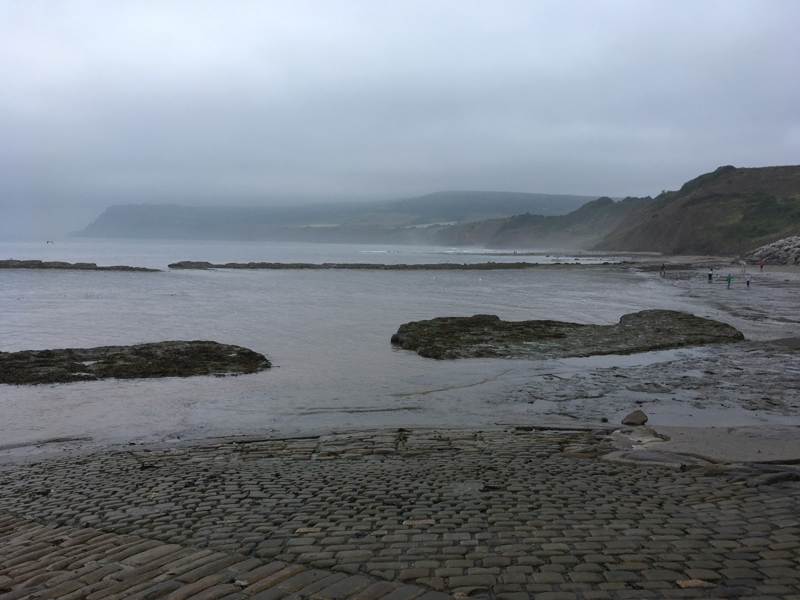
Make that superb views when it’s not foggy, though it is quite dramatic.
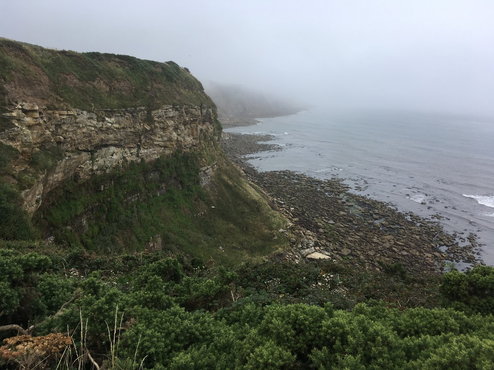

A cliff.


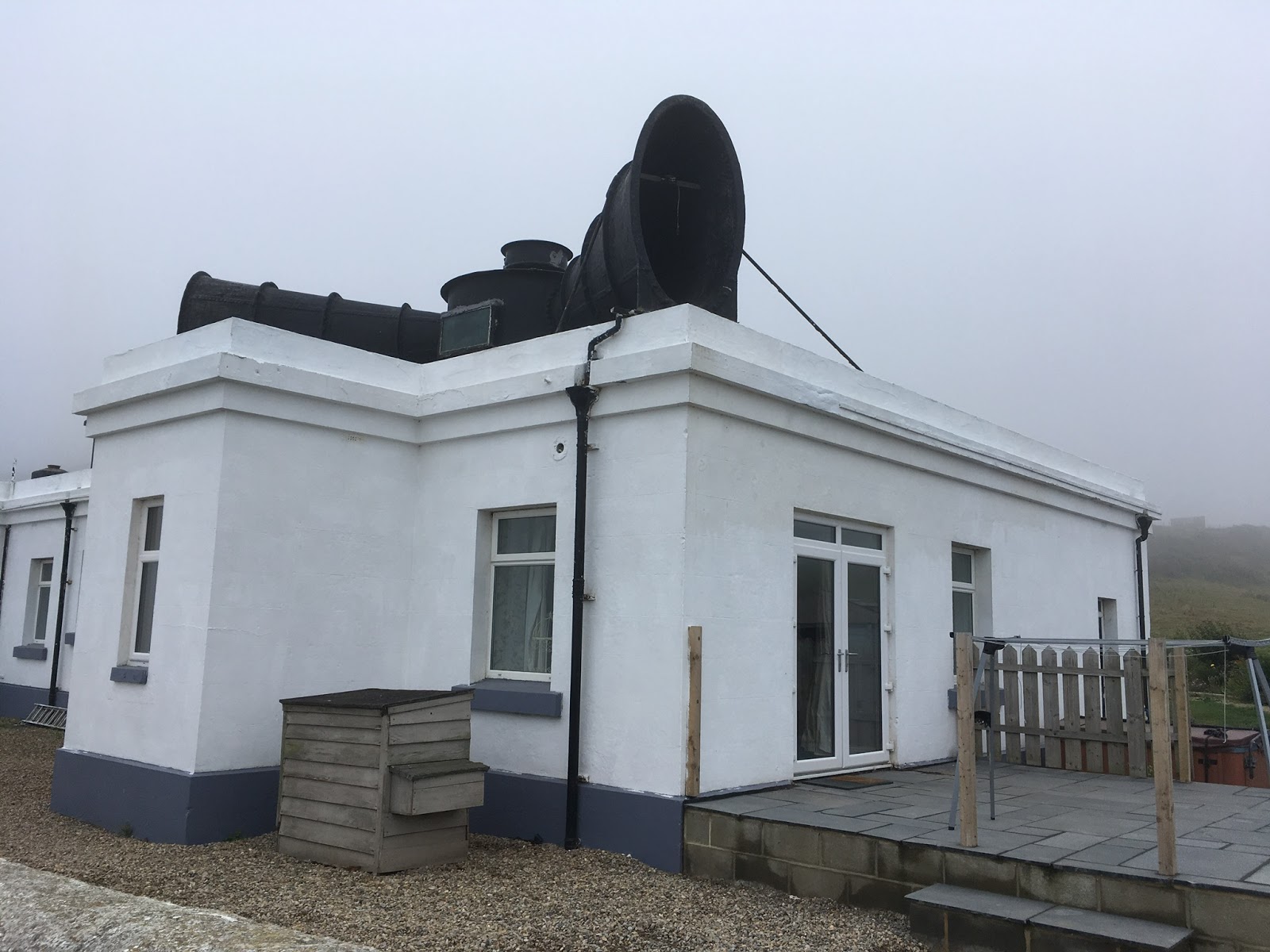
The latest fad - a foghorn on the roof.


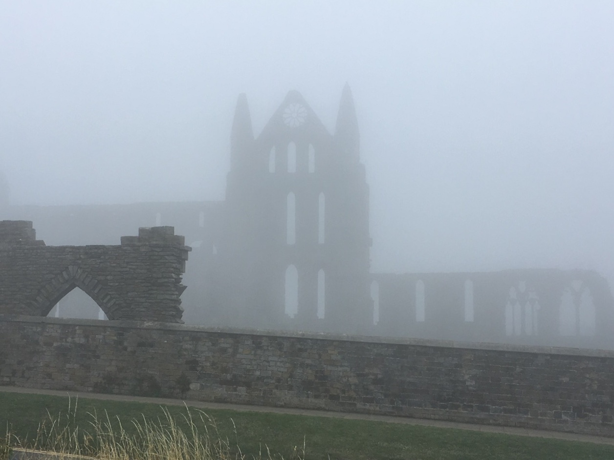
Whitby Abbey. Spooky.

So yes, it was foggy the entire way, but it did make for a moody ambiance! There was no threat of rain so we saw quite a few other walkers, especially as we neared Whitby. Last time I went there coincided with their annual Goth Weekend, an astonishing event inspired by the Dracula story (part of which is set there). This visit coincided with the annual Regatta, which might also have been astonishing but stood no chance compared to the enormous funfair taking up the entire west pier and surrounding area, with accompanying PA systems.


Welcome to Whitby!

We fought our way through the hordes to get to the beach so that I could throw my stone from the west coast of England into the North Sea, then ate fish and chips (Jen had scampi) at a seafront cafe, surrounded by total chaos. As I was ordering our food at the Beachside Cafe Bar the lady behind the counter dropped a tub of raw fish fillets on the floor. The owner’s response was “Get ‘em back in, quick.” When mine arrived I tried not to think about whether it had been sliding around by her feet 15 minutes earlier.
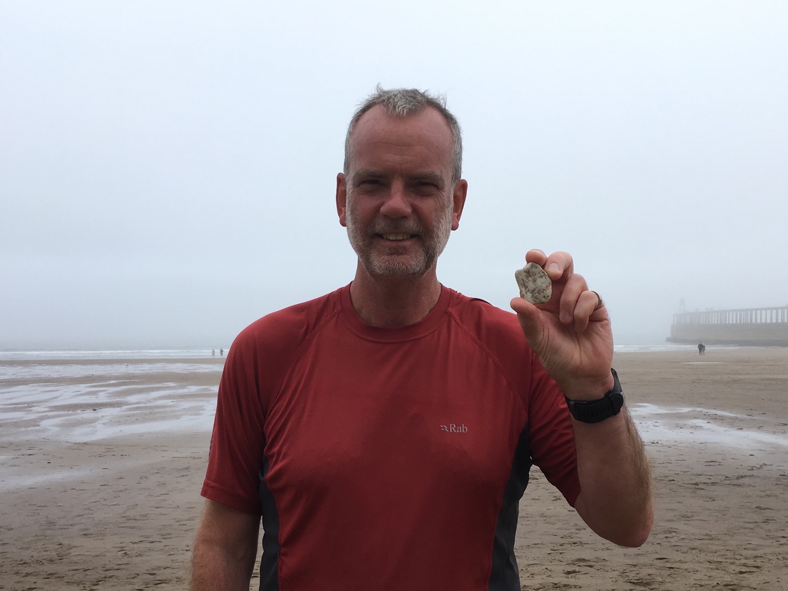

Stone and I.


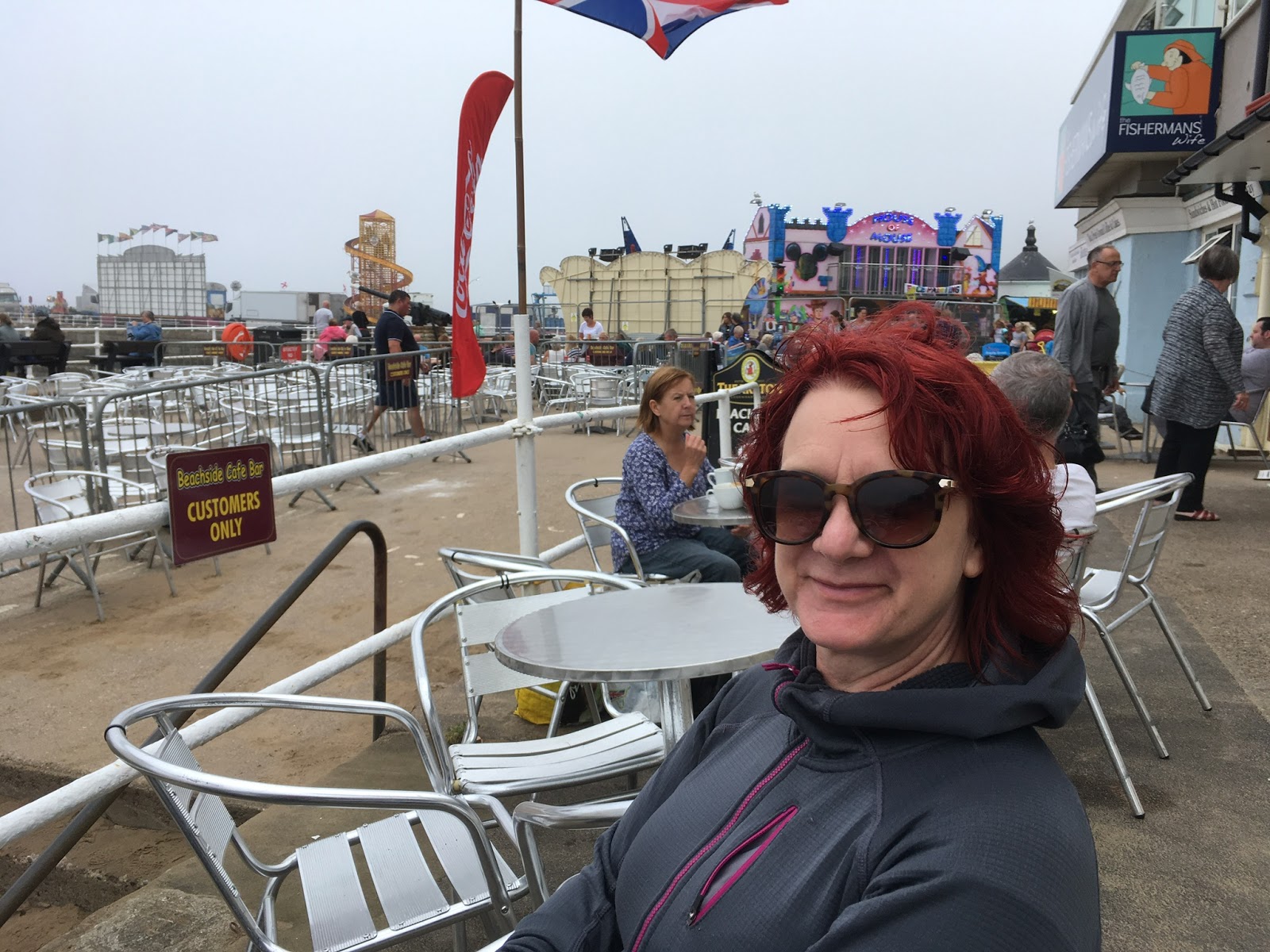
Jen, funfair and a cannon.

Walking to the bus station we did see some rowing boats, so it was reassuring to know that there was a regatta actually taking place! A quick tea and coffee stop and we were on the bus back to Goathland, then in the car back to Mold. What a long, strange and quite wonderful trip it’s been!


And finally, the adder video (though it's useless if you can't see it full screen!).
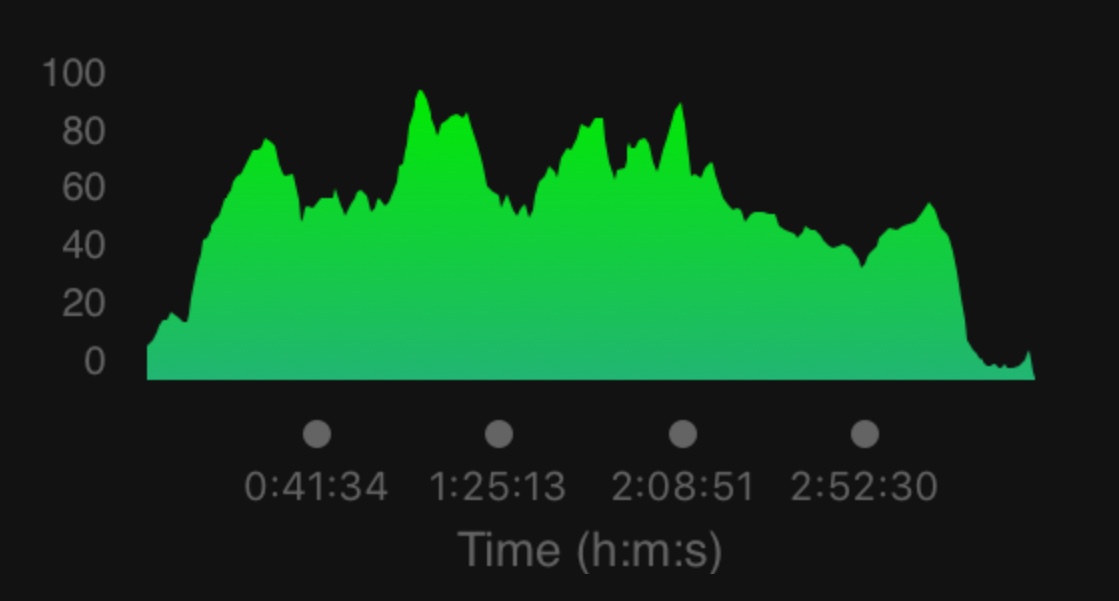
Stats Zone:

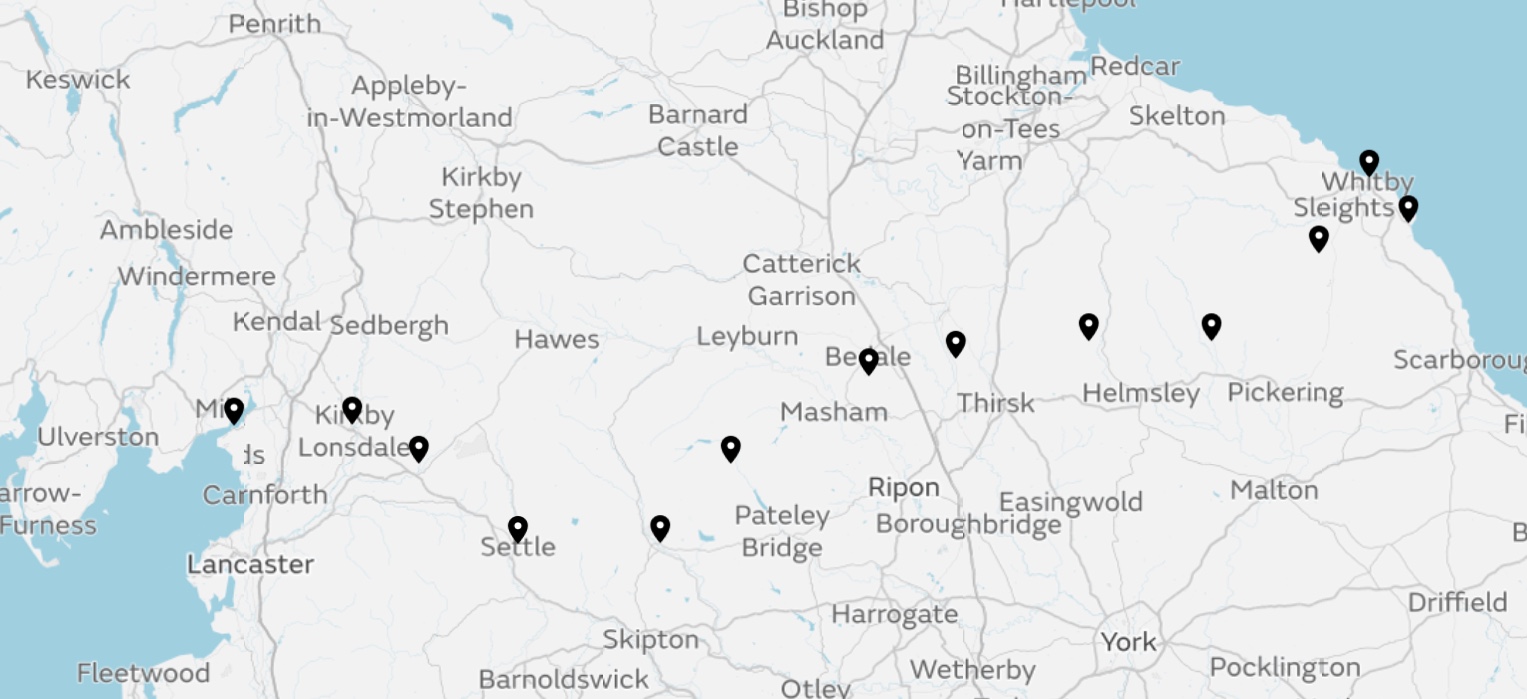
Total distance over 12 days, 194.8 miles.
Average distance per day, 16.2 miles.
Total ascent over 12 days, 7440m (24,409ft).
Average ascent per day, 620m (2034ft).


11.8.18

Day 10 - Hutton-le-Hole to Goathland, 16.9 miles.

Total ascent, 498m (1634ft).
Saturday, 11th August. 

In order of importance, United won 2-1, my steak and ale pie at the Crown was very good and the beer was ok. The pub was packed, until 9:30 anyway, so I was glad that for the only time during the walk I’d booked ahead by phone. I was watching the match on my iPad with wireless earphones; there’s always room for the technical essentials in my pack! I was conscious throughout of people watching over my shoulder and two of the staff members kept tapping me on the arm for updates. It was a good atmosphere that gradually shifted from holidaying families to post-watershed profane locals. One punter was consistently told to stop swearing, hopefully not for my benefit!

Breakfast was in the tearoom with lashings of coffee before I set off on another route that deviated wildly from the original. This time I had pre-planned it out of necessity rather than choice as there was no accommodation available on the actual Bay 2 Bay route. It didn’t take long before I’d changed this route as well. This time I decided that I’d planned too much walking in forest, which on the map looked like plantations, especially for a sunny day. What I didn’t want to do though was make it any longer as Jen was meeting me in Goathland to complete the walk with me (for a day and a half). 

In the end I skirted the early stages of the forest on lanes, which were pleasant enough and helped me to top up my farmer’s tan in glorious sunshine (possibly the last looking at the forecast). I noticed on the map a place nearby called Cawthorn Roman Camp so, having decided not to do any detours today, did one.

If you ever want to waste an hour of your life (and two miles walking in my case) go to Cawthorn Roman Camp. A signposted path guides you in an anti-clockwise direction through a wood, across some scrubland and back into the wood. As soon as I re-entered the wood I realised that the scrubland was the camp. I went back for another look, it was definitely scrubland. Nearby I saw a sign for a viewing platform so followed that. The platform didn’t even look out over the Roman camp, but over the valley in the opposite direction!


How are you supposed to camp on that?


From the viewing platform - not scrubland.

Relieved to be back on track my pointless detour was followed by a pretty woodland path but the sheer size of the conifer plantation made it impossible to avoid passing through at some point. I kept it down to just 2 miles, along a very wide track which made it much more bearable, though this stretch ended in bizarre fashion. 


Pretty.


Not as pretty.

I was about to pass between two forest corners which didn’t quite meet, leaving a gap of about 20 yards. Straddling the gap was a fence with a gate in the middle. As I approached I became aware of thousands upon thousands of ‘things’ flying through the gap, all from right to left (with the breeze). They were bees, and 50 yards to my left were their hives. I wasn’t sure what to do to be honest. I suppose I could have clambered through the edge of the forest or over the end of the barbed wire fence, but my final decision was to leg it. That meant legging it to the gate, getting through it and legging it back to the forest edge on the other side of the fence. I kept my head down and a few did land on me but only for a second. 

I walked a fair distance before the gap had widened enough for the bees to be spread out into less of a plague, and half a mile later reached open moorland at last. I now realised why the hives were positioned where they were. The heather on the moor was filled with the sound of buzzing - bee heaven! A mile of blissful walking later brought me to a proper summit with an impressive cairn and standing stones nearby. It was a beautiful spot for a late lunch at 2:30pm with only two miles to go (I’d done 15!). 


Bee heaven!

While I was sitting there a couple appeared out of nowhere. They were, shall we say, of a different era and were very reluctant to walk to the actual summit because I was there. They chose instead to look down, mumble something (possibly disapproval) to each other, walk a wide 180 degree arc around me and set off along the path I had walked up. I swear to God it was Keith and Candice Marie (and I suppose you either know who they are or you don’t)! 


Keith and Candice Marie keeping a low profile just out of shot.

The wander down to Goathland was equally blissful and I arrived at the Mallyan Spout Hotel mere minutes after Jen. We checked in and went for a wander. It’s a peculiar village with the houses spread out amongst common land, whose claim to fame is being the set of the well known TV drama ‘Heartbeat’ starring Nick Berry, which I didn’t watch. Every single shop was decked out in a 60s style, and I’m pretty sure it said that this was Nick’s police car...


He’s not going to catch anybody in that. 

So with Jen for company and rain forecast for the penultimate day tomorrow when we will reach the coast (we’ve now got as much walking to do to get to the coast as we’ve got to do along the coast afterwards), it seems like a good idea to pre-celebrate with beer and wine.

Stats Zone:


Note 2 miles of scrubland pissing about in the middle.


10.8.18

Day 9 - Hawnby to Hutton-le-Hole, 18.5 miles.

Total ascent, 720m (2362ft).
Friday, 10th August.

Well there’s no doubt that Laskill Country House will win my prestigious ‘Even Better Than Winning 4 In A Bed Best Accommodation Of The Bay 2 Bay Walk Award’. There was nowhere I could get to on foot for a meal and I’d completely forgotten to contact them beforehand to ask for something, but the owner Mandy made me a fantastic chicken salad which went down beautifully with a couple of bottles of Black Sheep Riggwelter. She had guests / friends eating with her so I sat in the lounge and relaxed. It was bliss!


I totally forgot to ask about this!

Mind you B&Bs often come with a level of expectation to chat, so upon first arrival I was met with coffee, delicious cake and a couple from Essex who pretended to be interested in my walk even if they weren’t, and I in turn pretended to be interested in shooting. They were also at breakfast along with another gentleman, a man of few words who, when he did speak sounded incredibly like Professor Snape. It looks like I am to be haunted forever! 

Anyway today the Essex couple were heading back to Essex to shoot things and Snape was heading to Port Sunlight to visit the Lady Lever Art Gallery. I enthused about the gallery, Pre-Rafaelite painting in general and Port Sunlight village. I warned him that he might want to give the area around Port Sunlight a miss. I suggested a short train journey to Liverpool Walker Gallery to see further Pre-Rafaelite masterpieces. All the while he stared intently at me, said nothing and considered at length what he was going to turn me into. 

So it was raining at breakfast and I prepared to get wet for the first time in a week, but was I going to? It had stopped before I left and I checked the forecast for where I was (rain in the afternoon) and where I was going to (no rain in the afternoon). Something had to give. As usual there was a rubbish path section, this time the first half mile. I’ve noticed that when the paths are good the mileage I cover is what I expect, and when they’re rubbish it’s much more because I spend so long zigzagging around to find the best route. 

I wasn’t happy with today’s route on the map. I was in the North York Moors and wanted to be on them, not messing about in valleys and on piddly lumps, which is where I was being sent. As I approached the two mile mark I came to a junction and made a sudden decision to completely change today’s walk. My thought process was roughly as follows:
1. There are 3 main types of paths I can walk on; footpaths, bridleways and tracks. 
2. Very few people walk around here, so the footpaths at this time of year are overgrown. They might be rights of way but you often can’t use your right of way without a fight.
3. Bridleways are usually a mess because horses’ hooves create a mudbath, but they are dry at the moment and clear, so a good option. 
4. Tracks are good. 
5. If it chucks it down I want to be on the moor in the open, not struggling through a sweaty valley. 
6. The original route isn’t long enough and is mainly on footpaths in valleys. 
7. I need more moor. 

So now my new route, devised in 10 minutes at the junction, was totally different. I was now going to be following bridleways and tracks for an extra 5 miles or so and staying as much as possible on the moor, which turned out to be pretty much the entire time. Hey presto, the best day of the walk so far! 

I only had to descend twice, once to a beck and once into a pretty valley. And when the rain came I was ready. I’d climbed out of the valley and was ready for lunch. I’d seen heavy showers passing to the south all morning, but finally I spotted one that had my name on it. It was upwind and I could watch it approaching while I ate my lunch and got togged up; waterproof jacket, trousers and rucksack cover. I just sat on a rock and waited for it, which got silly in the end because I was in a dark grey world but it hadn’t started raining at all. I decided to get moving again and finally it poured. 15 minutes later it had passed and that was all I got. The next hour was overcast but after that I could see what was coming my way from about 40 miles away and it was all fluffy white clouds. 


Heading my way. 


Still not raining. Come on, let’s be having yer!

My main target had been the Rudland Rigg Ridge. The Moors are basically a series of very long, broad ridges running NW to SE, which means that the valleys, rivers and roads do too because they have to. Rudland Rigg went on forever and felt like the top of the world, even though the ridge a few miles to the east was higher! I noticed a road running along the top of that ridge and recognised it as Blakey Ridge. This meant something to me so I scoured the skyline north and spotted the Lion Inn, a pub on top of the Moors which is on ‘The’ Coast to Coast Walk. I was actually nearer to that walk than the one I was supposed to be on!

I walked the length of the ridge followed by the last 2 miles on my official route in glorious sunshine, the end rather a different affair to yesterday’s mess. I even recreated an event from two years ago when Jen and I escorted a beetle across a road. This time it was a snail with a yard to go to reach the other side. I needed a rest so I sat down and waited the 10 minutes it took. Only one car passed so I nonchalantly stuck my legs out into the road and pretended to read the map. And I suppose the punchline is that 20 yards later I saw another, this one just setting out, so I picked it up and threw it into the grass on the other side.


Nearly there!

I am staying in the Barn Guest House and Tearoom (oh yes!) in Hutton-le-Hole, a very attractive, quirky village with a stream down the middle of the main street and sheep all over the place. I was in time for a cafetière and slice of lemon and ginger cake before getting ready to go to the Crown Inn next door to eat and watch United play Leicester in the opening match of the new season, either on telly or on my iPad. 

Stats Zone:


The original route headed due east!


9.8.18

Day 8 - South Otterington to Hawnby, 19.8 miles.

Total ascent, 599m (1965ft).
Thursday, 9th August.

Dinner last night was chiefly ageing couples as expected, though there were a few businesspeople as well, plus me. Not a bad place to put on expenses. I wonder whether I should send all my accommodation bills to Flintshire County Council and claim for something or other. Occupational Therapy maybe? I had two courses to celebrate being somewhere posh, prawns then lamb, and both were very good indeed. 

I didn’t really know what to do after dinner. Typically I fancied going for a walk but decided rest was the best option, opting for the lounge instead. Nickelback were playing on the speakers which nearly sent me running for an early night, but in the end it was relaxing looking out of the window towards the Moors, even if the beer was as bad as the music. 


Solberge Hall Hotel. 

If I had a nutritionist he would say, “You eat really well, but what’s with all the beer?” I would shift uncomfortably in my seat and mutter something about it being “mainly water”, before heading down the “you only live once” and “life’s too short” angle, with a shrug of the shoulders style “what does it matter at my age?” finale. 

I mention this because I start every day really well, eschewing the full breakfast for a sensible combination of its components (say, poached eggs on toast), or smoked salmon with scrambled eggs or, as was the case this morning, some superb porridge with honey and fruit. I’ve usually destroyed my good work by the time of the final order of the day, a nightcap of another pint of bitter. Mind you I’m better than I was, nowadays remembering to rehydrate with water before having my first pint, rather than using the beer itself to rehydrate. 

I took a calculated risk today. I didn’t want to pay silly money for a packed lunch from the posh hotel, and couldn’t be bothered snaffling mini-croissants from the breakfast bar, so I gambled on one of the 3 villages I was going to pass through during the first 6 miles having a shop. I wasn’t finished with the boring bit yet, with the hills only beginning again after the final village, though an 8:30 start before the sun got going in earnest meant I rattled through those early miles. 

The first place I came to was Newby Wiske, a tiny place that appeared to have a problem with PGL, whoever they were, so had anti-PGL placards up nearly everywhere. I suspected it was some sort of NIMBY thing. I had not expected a shop here so I moved on to more promising territory. 


I discovered later that it was indeed a NIMBY thing. PGL wanted to use the old Police HQ as an Outdoor Education Centre for schools - “Get those pesky kids off my land!”

I walked through the first village, no shop. I continued to the second village, no shop. I kept going to the third village, Knayton, which would surely have one because it was next to the A19, no shop. This never happens in fairy tales. I was about to leave my current map and go onto a new one so I scanned my route ahead for any possible refreshments, but there were no pubs or shops. I checked my bag and found 2 B&B stem ginger biscuits. 

I spent the next few minutes considering possible plans of action. For example, should I divide the remaining miles into three and eat one biscuit at each of the two ‘staging posts’, or wait until I was near death and eat both, or eat both now and anticipate a gradual deterioration. I was on a lane at this point and was about to lie down in the nearest field and wait for the buzzards when I saw a sign for a caravan park. I soon found reception, where they sold crisps and biscuits, and after buying a topic, a kit-kat chunky, a 150g bag of crisps and an orange fruit shoot, felt more optimistic about my chances of survival. I also bought an 8 pack of Tunnocks as emergency rations. What would my nutritionist say?!


Looking back from the moor to the distant Dales. 

The next thing I knew I was on a moor and heading for a summit of sorts, having completed 12 miles without really noticing. I’d also joined a National Trail, the Cleveland Way. I stopped at the summit of sorts for a crisp break and sat on a stone next to a wall. I took a while for some reason, as there was absolutely nothing else around, to notice a sign right next to me. When I read it it completely changed the course of the remainder of the day. 


Tearoom alert! Tearoom alert! Tearoom alert!

I scoured the map for High Paradise Farm, discovered it was still on the moor about 2 miles south east and changed my entire route to fit around a visit. A tearoom would be the final piece of the jigsaw that would ensure my survival for another day. I then retraced my steps for 5 minutes before veering off the original path (hence the spike on the map below). 

It was at this point I noticed a curtain of grey to my right. It had gradually clouded over but hadn’t looked remotely like raining until now, and although it was a fair distance away it soon looked Biblical. As there was hardly any wind it seemed to just sit there in the sky and looked quite superb (but not really in the photos), though gradually it was creeping closer. The wind picked up now as it often does before rain and the sky became even darker. Eventually everything disappeared into grey and the rain began to fall, soon becoming quite heavy. But I didn’t care, I just ordered another cafetière and carried on watching it through the tearoom window. 


A better photo than the others, if nowhere near as dramatic. 

As I had made such good progress I sat reading in High Paradise tearoom for well over an hour. When I finally left it was much brighter and I made a conscious effort to slow down for the remaining miles. The moorland was vast and the sky was vast; a very vast vista. I spent ages hanging round a dead tree taking photos, then a dead sheep (gruesome death but I’ll keep that to myself).


 Very vast vista with dead tree (dead sheep not pictured).

I was reluctant to descend but had to eventually, and lo and behold after a superb day the second to last mile was bloody awful, through an overgrown plantation and culminating in a 100 yard scramble up a steep slope buried in bracken, brambles and nettles. I spent the last mile composing myself and wiping blood off my legs. Thankfully Laskill Country House is a beauty, and even better SENSIBLY PRICED!!! Interestingly I’ve been informed that it featured in the ‘4 In A Bed’ TV programme and won! I’ll need to find out more about that later. 

Stats Zone:


8.8.18

Day 7 - Snape to South Otterington, 16 miles.

Total ascent, 99m (325ft) - mainly stiles and embankments I suspect!
Wednesday, 8th August. 

Boring, boring, boring, boring, boring, boring, boring, boring, boring, boring, boring, boring, boring, boring. This is how I envisaged today’s walk, mile by mile (don’t bother counting, there are 14). It’s quite hard to devise a coast to coast route across Britain that hasn’t got any boring bits, even in Scotland. And of course in my case by boring I mean flat. I suppose somebody who finds flat parts interesting might enjoy today and find the hilly bits, well, awful. 

‘The’ Coast to Coast Walk has the same boring bit as this walk, just further north; a flat expanse separating the Yorkshire Dales and the North York Moors. The aim in my eyes is to get across it as quickly as possible, but the Bay 2 Bay seems to want to faff about in it for a while. So today’s route meandered around and didn’t finish as far away from the start as it should have. 

Last night I had the nicest meal of the trip so far: chicken stuffed with Brie, wrapped in Parma ham and served with Mediterranean vegetables. For some reason it was listed on the menu as chicken supreme, which does it a great disservice. My room was also great, as was breakfast, so a successful stopover all in all. 

During breakfast I had a sudden urge to order two doom metal records online, which I duly did from a shop in the Netherlands. I suspect this was the result of receiving subliminal satanic messages during my sleep. Honestly Jen, it really was, this village is powerful! It was also during breakfast that I decided to make today more interesting by typing the blog on my phone as I went along, mile by mile, as it would be so boring that I wouldn’t need to see where I was going for most of the time. I could also use a boredom rating, as unusually I don’t think I’ve rated anything out of 10 on this trip yet. So here are the Day 7 live updates (sort of):

Mile 1. Through Snape village followed by pretty uninteresting farmland (but I survived unharmed!). Passed a man with 2 dogs. One was a collie and I like collies. Boredom Rating: 6
Mile 2. A quite interesting mile through a stately home’s grounds, littered with horse jumps and strange miniature buildings. Passed a boy and a girl with 2 dogs; one appeared to be blind. Also the path passed through the garden of a semi-detached house! BR: 2


Yes it really is this way!

Mile 3. Boring farmland followed by a housing estate on the edge of Bedale. Was heading towards a woman with 2 dogs but when she saw me she turned and went the other way, quickly. BR: 8
Mile 4. Through Bedale town centre which included a coffee stop, so not really boring at all. Bedale reminds me a bit of Mold (with fewer charity shops and hairdressers), with the high street leading up to the church. Out via a pleasant, tree-lined path. BR: 2
Mile 5. Along a road. Followed a man looking down at his phone the entire time, probably doing exactly the same thing as me. BR: 9
Mile 6. It’s all kicked off! Through a short path of nettles and thistles to junction 51 of the A1(M). Through a revised road system on the cycle path, alongside the A684, past a service station and along another road. Awful but not boring so I don’t know what to do now. BR: n/a


So it’s fourth exit off the first roundabout, then straight ahead at the second.

Mile 7. Through dull farmland, made a bit more interesting by watching the wheat being harvested. BR: 6
Mile 8. Path irrelevant as it involved a pub stop in Scruton village. I was peckish but it was too early for lunch so I settled for a pint of Wainwright’s to plug the gap. BR: 0
Mile 9. Turnips. Many, many turnips. Then a nettly path up a railway embankment, a walk ALONG the railway, more nettles and another crossing of the A684. BR: 5


Yes it really is this way (again)!

Mile 10. Along a bridleway through farmland. BR: 8
Mile 11. Still on the bridleway. Eating lunch on the hoof. BR: 9
Mile 12. The bridleway is now on an embankment alongside the river. I’m shepherding about 300 sheep. It’s lovely and fun! BR: 0
Mile 13. Why did I have to leave the river? Will this bloody bridleway never end? BR: 10
Mile 14. No more, please! BR:10
Mile 15. Why is there a Mile 15?! It was only 14 miles when I measured it on the map with string. Finally turned off the bridleway onto a path alongside a dead straight horse gallop. It’s a mile long. BR: 10
Mile 16. Lane to my accommodation. At least I can see the finish now. BR: 9

Well that passed the time I suppose. As for my accommodation, well I’m not quite in South Otterington yet. When I was planning the walk I could find nothing in the area except the Solberge Hall Hotel, a former stately home and now a renowned wedding venue, apparently. The lady at reception seemed to accept my dishevelled appearance but couldn’t seem to accept that I’d walked here, as presumably nobody ever has before. In the end I wrote ‘no car’ in the Car Reg’ box and she seemed happy simply to have something in all of the spaces on the form. 

Stats Zone: